| Area |
Middle Trinity |
| Topic |
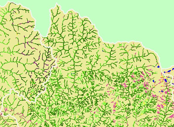
Map: 1D. USFS Riparian Vegetation Size, Middle Trinity Sub-Basin - N |
|
This is a map of 1999 USFS Landsat-based riparian vegetation size data for the northern portion of the Middle Trinity sub-basin.
Nearly all the large diameter trees are located in U.S. Forest Service lands at the eastern edge of the sub-basin. The vegetation
classification is accurate at a one-hectare scale and is suitable for stand classification. Tree diameters are larger in the northern
portion of the sub-basin than in the southern portion. Data were provided by the U.S. Forest Service Spatial Analysis Lab in
Sacramento, CA.
|
|
|
 |
 |
To view metadata about a map layer, click on a link in the table below.