| Area |
Eureka |
| Topic |
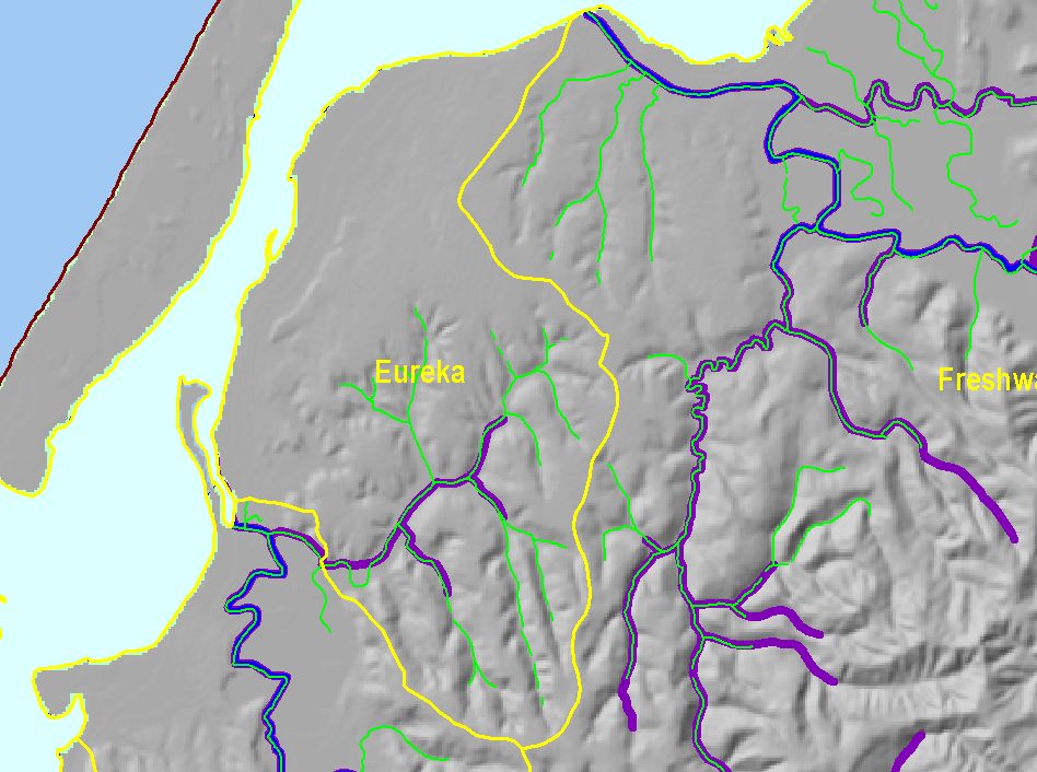
Map: L. Fish Distribution, Eureka Sub-basin |
To view a more detailed version of this map click
here
|
This is a map shows the distribution of salmonids in the Eureka sub-basin. Chinook and steelhead distribution were obtained from NOAA. Potential coho habitat was
calculated from stream gradient. Gradients less than or equal to 4 percent from the outflow were selected and saved. Any gradient steeper than 4% served as a cutoff
for any further potential migration up stream. These data are preliminary only, and were produced with the understanding that coho salmon are able to leap greater
than 4% for short distances. Therefore, the data are considered conservative estimates.
|
|
|
 |
 |
To view metadata about a map layer, click on a link in the table below.
If you obtain KRIS on a CD and install it on your hard drive as a desktop program, you will have access to increased map capabilities such as zooming in/out, turning layers on/off, adding layers and changing legends.