| Area |
Basin-wide/Regional |
| Topic |
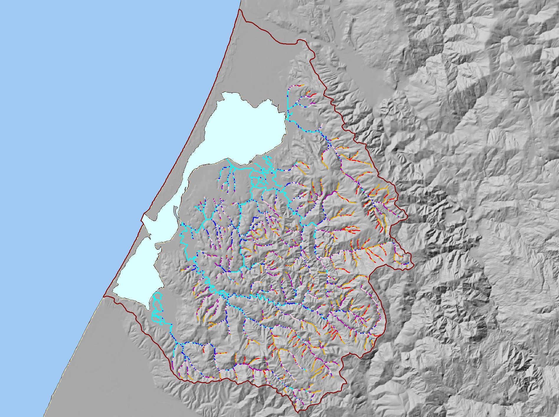
Map: N. Stream Gradient, Humboldt Bay |
|
This is a map of the stream gradients in the Humboldt Bay Basin. Gradient data were calculated by IFR GIS staff using 1:24k stream data and algorithms developed by
Dave Lamphear of the Institute for Forest and Watershed Management at Humboldt State University and Chris Keithley of CDF.
|
|
|
 |
 |
To view metadata about a map layer, click on a link in the table below.
| Name of Layer in Map Legend | Metadata File Name |
|---|
| Project Outline | Unavailable |
| Humboldt Bay | Unavailable |
| Stream Gradient in Percent (IFR) | stm24grad.shp.txt |
| Gray Hillshade (30 meter Resolution) [TIFF] | grayshade30m.tif.txt |
| Pacific Ocean | Unavailable |
| Humboldt County | Unavailable |
If you obtain KRIS on a CD and install it on your hard drive as a desktop program, you will have access to increased map capabilities such as zooming in/out, turning layers on/off, adding layers and changing legends.