| Area |
South Fork Battle |
| Topic |
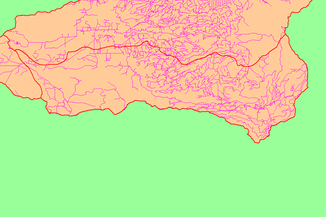
Map: 1C Roads, South Fork Battle Sub-basin |
To view a more detailed version of this map click
here
|
This is a map of the roads in the South Fork Battle sub-basin, displayed with KRIS sub-basins. In some areas, the GIS roads layer under-represents the network of
existing roads, particularly on public land in the eastern part of the basin. Road densities are lower in the South Fork than in the North Fork, b ut bedrock geology also
differs. Data were contributed by Sierra Pacific Industries and Lassen National Forest. Scale = 1:193,948 .
|
|
|
 |
 |
To view metadata about a map layer, click on a link in the table below.