| Area |
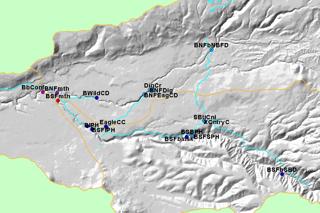
North Fork Battle |
| Topic |
Sediment: Percent Fines <2 mm at Bailey Cr Battle WA Sites |
To view a more detailed version of this map click
here
|
This map shows the locations sampled as part of the Battle Creek Watershed Assessment (Terraqua, 2004). Sites are color-coded by their EMDS "truth value" for
percent fines less than 2 millimeters. Site are overlayed on top of USGS 100,000 scale streams and KRIS sub-basins. Scale = 1:228,284 .
|
|
|
 |
 |
To view metadata about a map layer, click on a link in the table below.