| Area |
S Marin/Redwood Creek |
| Topic |
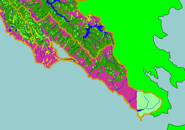
Map: 1D. USFS Vegetation Size, Southern Marin Sub-basin 1994 |
|
This is a map of 1994 USFS Landsat vegetation size data in the Southern Marin Coast sub-basin provided by the U.S. Forest
Service Spatial Analysis Lab in Sacramento, CA. Scale = 1:188,744 .
|
|
|
 |
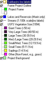 |
To view metadata about a map layer, click on a link in the table below.
| Name of Layer in Map Legend | Metadata File Name |
|---|
| Subbasins (no labels) | subbasins.shp.txt |
| Frame Project Outline | Unavailable |
| Lakes and Reservoirs (Marin only) | Unavailable |
| Streams (1:100k scale)(no labels) | streams100.shp.txt |
| USFS Riparian Veg Size (1994) | vegsizebuf.tif.txt |
| USFS Vegetation Size (1994) | vegsize.tif.txt |
| Topo Map, North (1:24k scale) | Unavailable |
| Topo Map, South (1:24k scale) | Unavailable |
| Project Background | Unavailable |