| Area |
Regional |
| Topic |
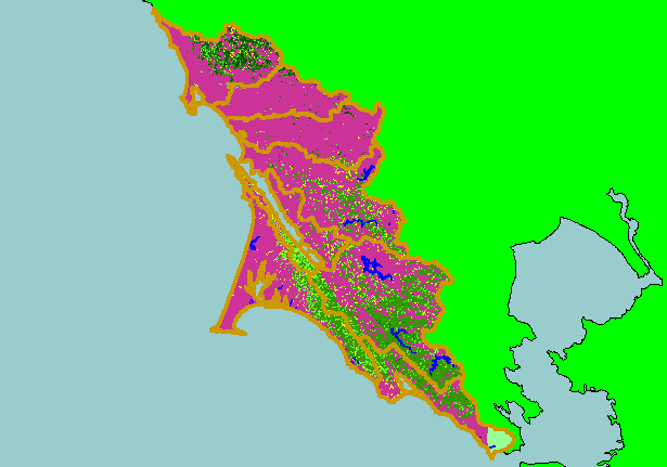
Map: 1H. USFS Vegetation Size West Marin-Sonoma 1994 |
|
This is a map of 1994 USFS Landsat-based vegetation size data for the KRIS West Marin-Sonoma project area. The large areas of
Non-Forest vegetation are largely due to natural grassy areas and chaparral with forested areas associated with areas of higher
relief and greater rainfall. The vegetation classification is accurate at a one-hectare scale (approximately 11 pixels) and is suitable
for stand classification. Data provided by the U.S. Forest Service Spatial Analysis Lab in Sacramento, CA. Scale = 1:636,992 .
|
|
|
 |
 |
To view metadata about a map layer, click on a link in the table below.
| Name of Layer in Map Legend | Metadata File Name |
|---|
| Subbasins (no labels) | subbasins.shp.txt |
| Frame Project Outline | Unavailable |
| Lakes and Reservoirs (Marin only) | Unavailable |
| USFS Riparian Veg Size (1994) | vegsizebuf.tif.txt |
| USFS Vegetation Size (1994) | vegsize.tif.txt |
| Topo Map, North (1:24k scale) | Unavailable |
| Topo Map, South (1:24k scale) | Unavailable |
| Project Background | Unavailable |