| Area |
Novato and Miller Creeks |
| Topic |
Aquatic Insects: EPT Taxa in Novato Creek 1999-2002 |
|
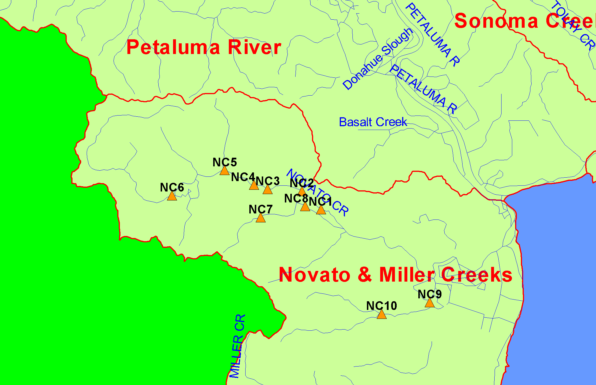
This is a map of 1999-2000 Marin County Stormwater Pollution Prevention Program (MCSTOPPP) macroinvertebrate sampling stations in the Novato and Miller
Creeks sub-basin, overlaid on top of KRIS sub-basins and USGS 1:100,000 hydrography.
|
|
|
 |
 |
To view metadata about a map layer, click on a link in the table below.
| Name of Layer in Map Legend | Metadata File Name |
|---|
| Macroinvertebrate Sampling Sites (MCSTOPPP) | macroinvert.shp.txt |
| Streams (1:100k scale)(w/ labels) | streams100.shp.txt |
| Subbasins (w/ labels) | subbasins.shp.txt |
| Frame Project Outline | Unavailable |
| Project Area Background | Unavailable |
If you obtain KRIS on a CD and install it on your hard drive as a desktop program, you will have access to increased map capabilities such as zooming in/out, turning layers on/off, adding layers and changing legends.