| Area |
Regional |
| Topic |
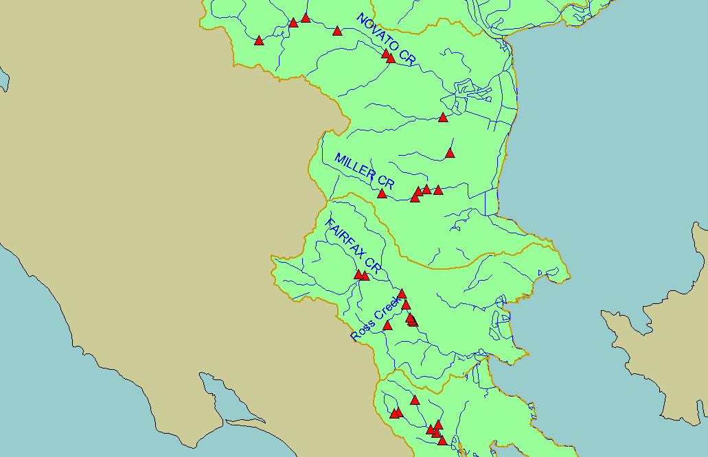
Fish: Leidy Salmonid Index for Marin County Sites |
To view a more detailed version of this map click
here
|
This map shows sampling stations in Marin County from the Bay Area Stream Fishes Database, overlaid on top of USGS 1:100,000 scale streams and sub-basins.
Fish sampling was conducted by Rob Leidy in the years 1992-1998.
|
|
|
 |
 |
To view metadata about a map layer, click on a link in the table below.
If you obtain KRIS on a CD and install it on your hard drive as a desktop program, you will have access to increased map capabilities such as zooming in/out, turning layers on/off, adding layers and changing legends.