| Area |
Regional |
| Topic |
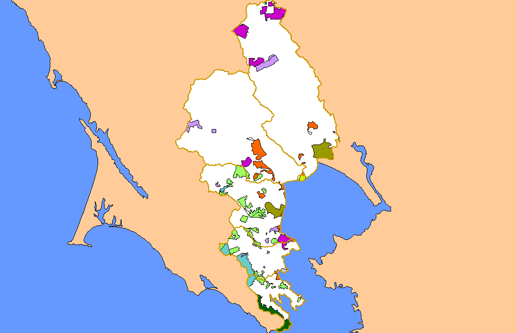
Map: 1L. Land Ownership, East Marin-Sonoma |
To view a more detailed version of this map click
here
|
This is a map of the land ownership in the KRIS East Marin-Sonoma project area, overlaid on top of KRIS sub-basins.
|
|
|
 |
 |
To view metadata about a map layer, click on a link in the table below.
| Name of Layer in Map Legend | Metadata File Name |
|---|
| Subbasin (no labels) | subbasins.shp.txt |
| Frame Project Outline | Unavailable |
| Ownership (CASIL) | govtown.shp.txt |
| Project Area Background | Unavailable |
If you obtain KRIS on a CD and install it on your hard drive as a desktop program, you will have access to increased map capabilities such as zooming in/out, turning layers on/off, adding layers and changing legends.